Rural Trulli Beyond Alberobello: An Itria Valley Route
Alberobello draws two million visitors a year. To understand Puglia's farming architecture, take the smaller roads of the Itria Valley.
Alberobello has a problem: its old town has become an open-air shopping centre. Stone cones house souvenir shops and wine bars. To see trulli in their original farming setting, you only need to head a few kilometres south.
Rural trulli in the Itria Valley: shelters from the heat
An isolated trullo in a field was built for practical use, rather than its appearance.
Puglian farmers built trulli to store tools, shelter an animal or sleep in during the harvest weeks. Looking at these buildings beside country roads reveals the architectural logic that visitors can miss in the towns.
© JP Vets / Wikimedia Commons - CC BY-SA 4.0
The walls are built dry, without mortar, by stacking blocks of limestone taken directly from the land. This double layer of stone keeps out the summer heat.
The best way to experience their insulation is to stay the night. Avoid renovations that have cut large windows into historic façades. Trullo Sereno, tucked away in Contrada Trito, has retained its windowless walls and original roof, with nights from €120.
Inside, the silence is complete. Without large glass windows, the rooms stay pleasantly dim for an afternoon nap. The stone's thermal mass keeps the temperature at 24°C in August without air conditioning.
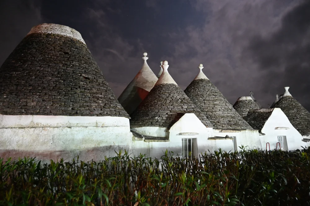
Stop along the country lanes and you will notice that most rural trulli have no elaborate pinnacles or lime-painted roof symbols. These decorative elements are later urban or residential additions.
Rural trulli are rough and grey, blending into the surrounding rock. The limestone roof slabs, or chiancarelle, slope slightly outwards so water runs off, keeping the structure watertight before filling the underground cistern.
Locorotondo: the vineyards of the contrade
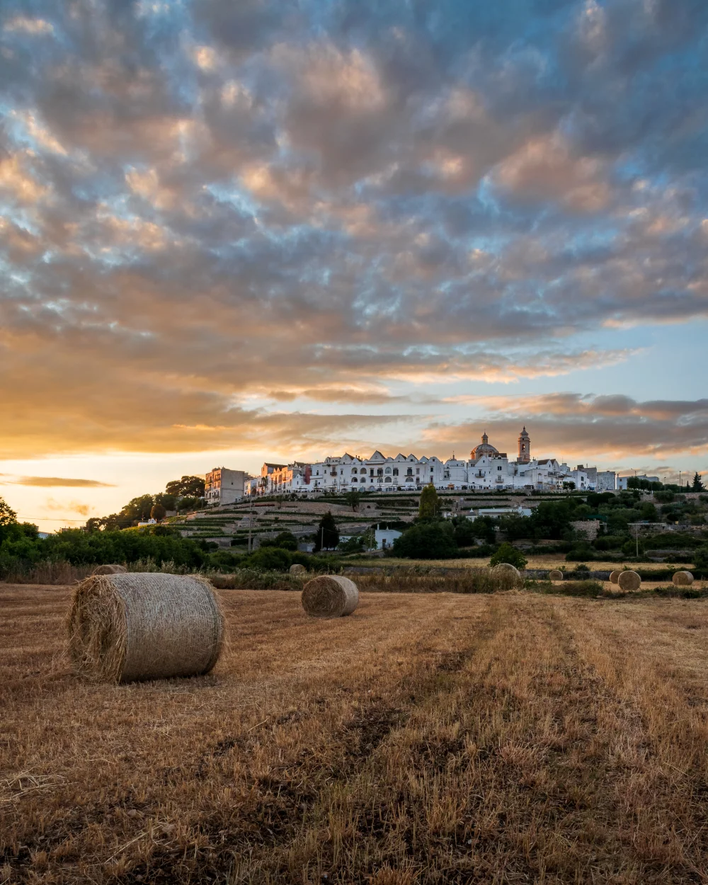
Locorotondo has a circular layout on a hilltop. The white town has steep, double-pitched roofs called cummerse, very different from Alberobello's cones.
Looking down from the viewpoint on Via Nardelli gives you a sense of the scale of the surrounding countryside.
© Frankthroughtheglass / Wikimedia Commons - CC BY-SA 4.0
Locorotondo belongs to ‘I Borghi più belli d'Italia’ and holds the Touring Club Italiano's Orange Flag, an award for the quality of its welcome and the walkability of its old town.
For the views, follow the lungomare, the little street circling the hilltop at the edge of the centro storico. Along the way, Villa Comunale, a 19th-century garden, offers welcome shade in summer.
The Itria Valley spreads out below, divided by a dense network of dry-stone walls. Local land records divide this countryside into more than 140 contrade, small rural hamlets whose names appear on local road signs.
This is where the trulli are most concentrated. Take the car onto the small paved roads leading from the foot of the hill, for example towards Contrada San Marco or Contrada Trito.
Vineyards shape the landscape here. Low, trained vines grow in bright red, iron-rich soil. The main grape is Verdeca, which makes a dry, strongly mineral white wine.
To taste the local wine, stop at Bottega de I Pàstini, the winery's shop in central Locorotondo. Allow around €5 for a bottle of Antico white.
Another option is Azienda Agricola Bufano, a vineyard on the village's upper slopes, where tastings take place seated on hessian sacks between rows of vines, with the valley below.
Trulli emerge among these geometric plots. Unlike Alberobello's closely packed houses, the cones stand in little groups of three or four, joined to form a farm.
They provided living quarters during the grape harvest, allowing families to stay on site. Access lanes are narrow, often only one vehicle wide, with stone walls tight against their edges.
Cisternino: the valley from the Puglian Aqueduct
South of Locorotondo, towards Cisternino, the landscape changes. Vineyards gradually give way to olive trees.
Some fields hold enormous specimens, although the Xylella outbreak has forced the clearing of many plots further south towards Salento. The Itria Valley is still holding out, and grey-green olive leaves dominate the horizon.
The best way to see this area without engine noise is the cycle path laid directly over the roof of Europe's largest aqueduct.
The underground aqueduct carries water from Campania to the tip of Italy's heel. The Itria Valley cycling stretch runs for around fifteen kilometres, mainly between Figazzano and Ceglie Messapica, through the countryside of Cisternino.
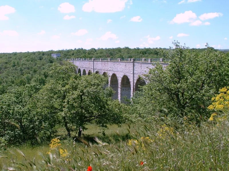
The Figazzano aqueduct bridge is the obvious starting point: water flows beneath the path.
© The original uploader was Istvánka at Hungarian Wikipedia / Wikimedia Commons - CC BY-SA 3.0
The compacted-gravel path is closed to motor vehicles and protected by wooden rails. It winds along the hillsides through the scent of wild fennel.
From the saddle, you look down over fields and casali, clusters of trulli forming small enclosed courtyards.
ebike Puglia, based on the SP58 Via per Alberobello in Martina Franca, hires out electric bikes by the day. Allow around €35, depending on the season. Electric assistance is essential for the climb back to the hilltop town after your ride.
On this path, you get a sense of how isolated these farms are. Abandoned trulli stand beside others that have been bought and restored.
The façades reveal the region's recent history: original structures have weather-blackened stone and brambles growing in the gaps, while recent renovations stand out with neat mortar joints and pools cut into the limestone.
Martina Franca: rock, oaks and livestock
Martina Franca stands apart from the rest of the valley. Its old town is a maze of Baroque architecture, bulging wrought-iron balconies and opulent palazzi.
At 431 metres above sea level, it is the area's highest town. Its economy historically grew around cattle and horse breeding rather than vineyards.
Leave Martina Franca heading west on the SP58 or SP53 and the countryside becomes rougher. White rock outcrops cover the red earth.
The Macedonian oaks of Bosco delle Pianelle cover the hills. This is the land of large livestock masserie.
© Mastrocom / Wikimedia Commons - CC BY-SA 4.0
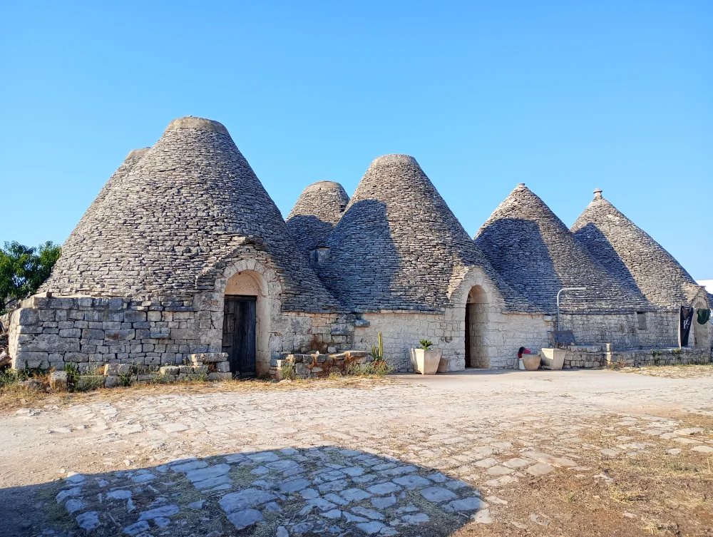
Here, the trullo takes on another role. Instead of the main home, it becomes an outbuilding of the masseria. Large groups of cones adjoin the fortified courtyards.
They served as stables for Murgese horses, the large black animals native to these hills and well suited to rocky ground. The doors are wide enough for livestock, and inside are feeding troughs carved into stone blocks.
To get close to these horses and understand how the farms are organised, book a table at Masseria Sant'Elia, where the set menu costs around €35.
Dinner is served in the farm courtyard, surrounded by storage trulli. Try Capocollo di Martina Franca, a cured pork speciality produced nearby. It is marinated in cooked wine and smoked over Macedonian oak bark.
The weather changes more quickly here. Wind sweeps through the wooded hills, and temperatures drop from 5pm, even in July.
An Itria Valley drive: a two-hour late-afternoon route
A hire car is essential for exploring these rural landscapes. Choose a Fiat 500, Panda or similarly compact model rather than an SUV.
On these lanes, dry-stone walls often come very close to the bodywork when you pass a tractor. Always choose zero-excess insurance when booking through Rentalcars. If a farm van approaches, you may have to reverse fifty metres to the last junction.
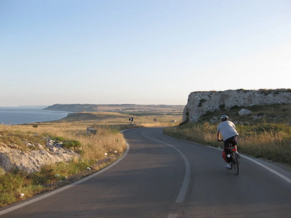
© Piccolina Adventures / Wikimedia Commons - CC BY-SA 3.0
Allow around two hours of driving to cover these three areas, plus time for stops. From Locorotondo, head down Via Alberobello to reach the SP134.
This small road cuts through vineyards and passes dozens of unrestored farm trulli. Then turn onto the SP17 towards Cisternino: the road widens slightly and olive trees replace the vines.
After Cisternino, take the smaller SP61 towards Martina Franca. This quiet, hilly stretch passes through the hamlets of San Donato and Capitolo. You will pass Ashram Bhole Baba, a meditation centre established here in the 1980s.
For photos, use the few pull-offs at junctions. Blocking a lane with a Fiat 500 while a local farmer waits is best avoided.
Plan the drive for late afternoon, between 5pm and 7pm. Low sunlight catches the whitewash and stretches the conical roofs' shadows across the red earth.
Farmers bring in their machinery and local traffic eases. Keep an offline map on your phone: there are many spots without 4G coverage once you leave the main paved roads.
If you get lost in the maze of contrade between Cisternino and Martina Franca, do not reach for the satnav straight away. Follow the dry-stone walls: the lanes eventually widen and lead back to a paved provincial road.
7 days among ancient olive trees, whitewashed villages and dramatic cliffs. A leisurely way to savour southern Italy at 15…
Read more →Dreaming of Alberobello's trulli but dreading the crowds? Here is how to explore this stone-built village at the hours when…
Read more →